Monarch Mountain expands terrain to allow skiers to cross the Continental Divide
A 377-acre addition at the 2026 season opener creates the only resort slope in Colorado that spans the geographic boundary.
By Martin Reynolds ·
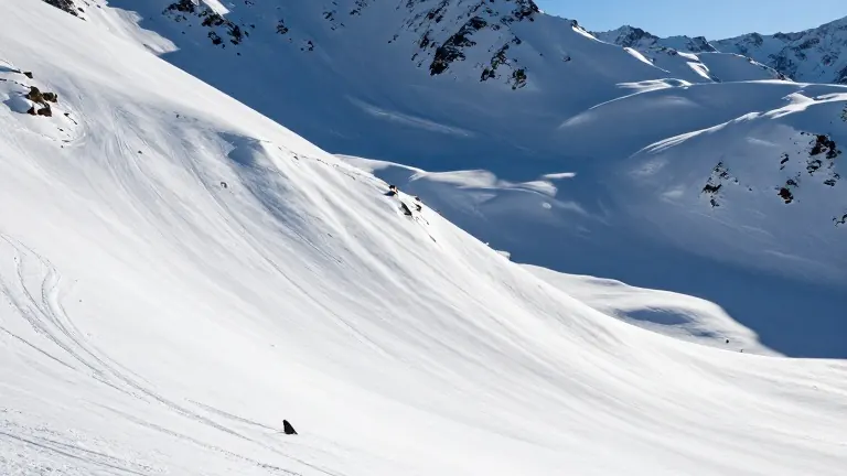
377 acres of new ski terrain opened at Monarch Mountain this fall, creating the only place in Colorado where resort skiers can cross the Continental Divide during a standard day on the slopes.
The expansion, known as No Name Basin, connects the front side of the mountain near Monarch Pass on U.S. Highway 50 to the backside terrain. Skiers now drop into this new bowl and traverse the geographic spine of North America on every lap. The divide separates the watersheds that drain toward the Pacific Ocean on the west from those flowing to the Atlantic on the east.
The Continental Divide runs from New Mexico to Wyoming along the Rocky Mountain crest. It passes through towns including Aspen, Breckenridge, and Buena Vista. In Colorado, the feature reaches a maximum elevation of 14,270 feet at Grays Peak. The lowest point sits at 8,643 feet near the Rio Chamita in Archuleta County. While legend suggests one side is always colder, elevation is the primary factor affecting temperature on the mountain.
Eva Egbert, brand experience director at Monarch Mountain, described the new backcountry area as an extremely quiet bowl with advanced terrain. The mountain relies entirely on natural snow, which Egbert noted skis better than artificial cover. Monarch Mountain is not included in major multi-resort passes, but the independent area maintains a network of more than 30 local partners, including Loveland, A-Basin, and Copper, for three-day ticket exchanges. A season pass for uphill travel costs $79, allowing skiers to skin or snowshoe up to the divide.
Beyond skiing, the divide offers various access points for travelers. Paul Talley, executive director of the Colorado Trail Foundation, noted that the 567-mile Colorado Trail overlaps with the Continental Divide Trail for more than 300 miles. The Continental Divide Trail was designated a national scenic trail in 1978. Jordan Williams, Colorado regional representative for the Continental Divide Trail Coalition, described the 3,100-mile footpath as a patchwork with numerous access points. He recommended lower elevation options in Grand County, such as the Devil’s Thumb Trailhead in Fraser, for current fall conditions.
For cyclists, Shawn Gillis, owner of Absolute Bikes in Salida, points to Marshall Pass. This route features a gentle 2% grade and is part of the Tour Divide bikepacking race. Gillis stated that fall colors persist into November on the pass. The ride offers a long descent back to Salida, where the shop provides tune-ups and shuttle assistance.
Rail travelers can pass under the divide via the 6.2-mile Moffat Tunnel. Amtrak’s California Zephyr, which runs from Chicago to Oakland, travels through the tunnel at 9,200 feet. The train emerges directly at the base of Winter Park Ski Resort. Paul Hammond, executive director of the Colorado Railroad Museum, identified the 99-year-old tunnel as the only iron-rail passage through the divide. The Canyon Spirit, a seasonal luxury train, and the Winter Park Express also use the route.
Driving options include Trail Ridge Road in Rocky Mountain National Park. The 48-mile stretch between Estes Park and Grand Lake climbs to 12,183 feet. It is the highest continuous paved road in North America. At Milner Pass, the road crosses the divide at 10,759 feet. The route is typically open from late May through mid-October.
For those seeking backcountry access, Ben Coryell, owner of Golden Mountain Guides, highlighted trails near the Eisenhower Tunnel. The Dry Gulch Trailhead is located off Exit 216 on Interstate 70. The Herman Gulch Trailhead sits a couple of miles east of the tunnel near Silver Plume. Coryell noted that solid intermediate or advanced resort skiing is a prerequisite for these backcountry routes.
Source: The Denver Post · original report published